For this year's Georgian Bay summer holiday review, I figured we'd look mostly at places that we visited for the first time, as I know you don't want/need to see all of the same old, same old. Right?
That is, unless I got some particularly nice shots at Henry's again that are simply too nice to pass up. Or Parry Sound. Well, you get the idea. . .
So, since we are already on the subject of Henry's World Famous Fish Restaurant, when we were there this year for a few days, we took a dingy ride over to Wreck Island to check out the remains of the wreck of the side paddle wheel ship, 'Waubuno', which was lost in a gale on the night of November 22, 1879.
The significance of that date is two-fold, as it's 132nd anniversary is only days away (from the date of this posting) and the 22nd of November is also the date that President Johnathan Fitzgerald Kennedy was assassinated.
 |
| Photo Credit: http://www.southchannel.org |
We're going to start with this historical plaque which is actually located in Parry Sound, well north of the wreck site. The reason for this is that the the Waubuno had been heading for Parry Sound on it's fateful last journey when it was lost;
This anchor from vessel is located next to the historical plaque in the park, which is ironically in a place called 'Anchor Park'! How cool is that, that they were able to find a park with a a name that suited the anchor / Anchor Park relationship ;-)
On to the wreck site. Another bit of irony for those of you taking notes - the wreck is actually just off of 'Bradden Island', which is right beside Wreck Island;
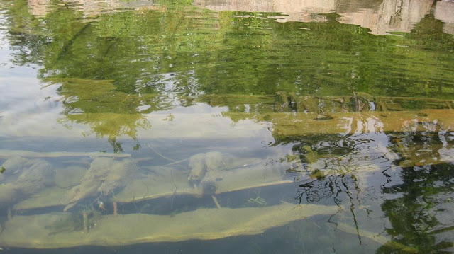
Here's a shot of the remains from the surface;
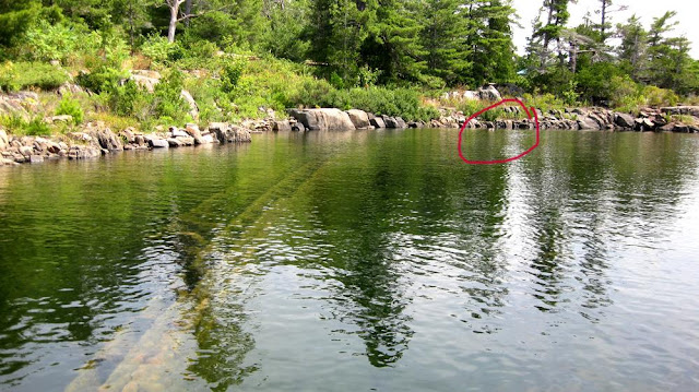
Here's a long shot of the resting place, showing how close it is to shore. The red circle is where the bow of the boat is - the only part of the boat that is sticking out above the water's surface;
I was amazed to see how much has survived after 130 + years;
Looking back westward from the wreck site towards the open Bay, one can see the two giant rocks that protect the remains from the full fury of Georgian Bay.
So, how did it get here, you ask? Remember that the water level has dropped roughly five feet (!!) in the past 20 - 25 years, and the gale that caused it's demise would have resulted in a storm surge of three or more feet, so the ship would have been able to easily clear (or be pounded on) those rocks back in the day;
More cool shots;
The bow of the ship, currently above the surface level;
The keel of the ship;
Here's some really cool underwater video;


No comments:
Post a Comment