Showing posts with label port severn. Show all posts

Sunday, March 18, 2012

Last Bay Pics of 2011

 Anchor Girl & I took a spin up to the marina today to check on the boat and the ice conditions. For those of you who haven't been up Lake Simcoe much this winter, the main part of the lake didn't freeze over until the second week of February - the latest I've ever seen that - and broke up a couple of weeks ago when we had those many days of high winds. As of today, Cooks Bay (south end of Simcoe) is still covered in ice, but looks like it'll be gone this week. The marina at Lagoon City still has ice, but there is lots of open water all around & everything should be open and ice free this week.
 Good news is, with all this favourable weather, that we are looking at  an early launch this year!! Given the fact that Boogaboo is on land and strategically located right next to the launch ramp, I've scheduled it to go back in the water the first week of April, so that we can be back on board for the first long weekend of the season!!
Bring it on!


 Today's post will take us through the last part of our 2011 Georgian Bay travels. I hope you enjoy it.

Back at Henry's on our return trip. Juts one more glorious evening on Georgian Bay;

Beautiful;

This is the cottage across from Henry's. See the flag pole in front? Well, it's actually depicted as a 'flag staff' on the nautical charts, which is different from a 'flag pole' - but only up close :-)

My lovely Anchor Girl, dipping her feet in the water;

A couple of float planes from Georgian Bay Airways preparing to depart;

Here's those same two planes from the above photo taking off . Plus a really nice view of a summer evening at Henry's;


Nice sunset;

Pretty;


While here, we happened to see Brian (from Keswick Marine) bringing his new boat home from the States. He was accompanied by his brother & Peetah and they stopped in for us to take the grand tour of the boat. I remember that it was VERY hot that day!


One more photo from our (previously posted) dinghy trip to Moon River Falls;

Very nice;

Summer. Nice.

All good things come to an end, and we left Henry's the next morning;

As this would be our last day on The Bay for the season, I was gonna drive back real slow . . .

Slow driving or not, we was back at Honey Harbour too soon;

The Picnic Island store & gas dock in Honey Harbour;

Rounding 'Turning Rock';

This is the calmest conditions we had ever encountered on Severn Sound;

The north cardinal buoy closest to Port Severn. Unbelievably calm waters;

Unfortunately, those calm conditions wouldn't follow us into Lock #45. Here we are approaching the highway #400 overpass & the lock behind it;

Oh. Calm waters have been replaced by a very strong current at the bottom of the lock. We had to hover in these conditions for roughly 40 minutes. Not a fun thing to do in a small, congested area surrounded by rocks and other drifting boats;

Safely at the blue line, waiting to enter the lock;

Does my wife appear stressed out in this shot? The answer is 'yes'. You gotta watch the video below to get a feel for the approach to this lock. Definitely the least favourite lock to pass through - by far;

Here we are with ten minutes of fun passing through the lock at Port Severn;


Look at that. We made it through without loosing any fingers or anything. Well, a little scuff of blue line paint on the side of the boat, but that was easily buffed out;

Here it is. I like to call these little abrasions 'Memory Marks' :-) Heck, if we never left our slip, we'd never have all our great memories from our adventures;

The dock at Rawley Resort in Port Severn. A nice, 5-star inn which is our traditional 'last night' place to stay and go for dinner in their restaurant. And they even let in people dressed like me;

One last beautiful sunset for our holidays;

At least I wore a nice Hawaiian shirt for the occasion;

Even got the moon in this pic;

Wow;

Here's a clip I took the next morning before we headed on. I told you it was worth it;


Back on the move along the Trent Severn Waterway;


13 minutes to ride back up the Big Chute Marine Railway. We couldn't have timed it better, as we simply drove right onto the car - no wait at the blue line. Counter that with our 2009 return when we had a three hour wait to go over;


Let's go up Lock #43 at Swift Rapids;


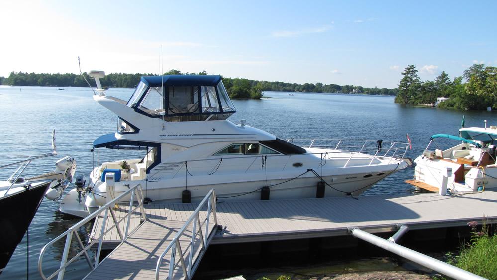
 A nice shot of Boogaboo, taken from the 'Over Doo' crew docked at 'The Wabic' restaurant;


Approaching the last lock, #42;

The Narrows on Couchiching. That means we are almost home;

Back at Pefferlaw, entering the break wall and on to our marina. This was one of the last times we entered this way, as we would be moving to Lagoon City in less than a month from when this was taken;

I'll end this trip with a clip from one of my favourite settings, enjoying a spectacular sunset at the Rawley Resort;

Sunday, January 31, 2010

Open Water at Port Severn + Visiting Honey Harbour

Yesterday, Anchor Girl & I took advantage of the sunny day and, as planned, went for a drive to check out the Georgian Bay scene. The first stop was at the Port Severn Lock (#45) and from there, a bit farther north west to Honey Harbour for a round trip of about 350 km.

On the way back, we dropped into West Marine to get a couple of little things for Boogaboo, including a new compass that I will mount in such a way that I'll actually be able to see it when I have my charts out. As it is now, the only spot I have to lay out the charts is right over the factory mounted compass. That one will come out to make a flatter surface for the charts. Anchor Girl thought the new compass might come in handy the next time we are shrouded by thick fog and can't even see the front of the boat. Or the boats behind (?) us . . .

 Despite the cold, -14 degree day, it wasn't too bad with the sun shining brightly. Made for a nice day close to the water. And yes, there was open water at Lock 45;

The water was really flowing from the dam next to the lock, so there was lots of open water;

Here's a super zoomed in shot of the water churning at the bottom of the spillway. See how the spray has caused the icicles to form like stalactites;

 As was the case when we dropped down through here on our holidays, the force of the rushing water was so great that it was pushing the port hand buoy over like one of those dummies that you punch and it bobs back up. Not sure what those things are called, but the result is the ice forming a heavy coating where it was continuously in and out of the water; 

The top side of the lock. Looks pretty in the sun, even though it's winter;

 To get a feel for the incredible zoom on our new camera, I took this shot of the Picnic Island store while standing next to the Delwana Inn. For those of you who know how far away they are from each other, you will have a greater appreciation for this shot and the clarity the camera was able to capture from such a distance. According to the distance measuring tool on Google Maps, it is 2244 feet between these two points! This zoom feature is gonna be great for lots and lots of picture taking this summer;

 Next, I have three video clips I took yesterday up in these parts, but wanted to give you all a heads up on the newest technology we will be enjoying henceforth.  Not only does our new toy - I mean camera - have a 20 times optical zoom, it also records video in HD (High Definition). So, that means we can all enjoy moving pictures that are way clearer than before!

 The one hitch is that your computer has to be powerful enough to display the HD clips. Don't worry, if your machine is any newer than four years, should be no problem. I can even play the vids on my laptop, which was the cheapest one I could find four years ago. It has a relatively (by today's standards) slow processor and a low end video hardware accelerator. I did have to download and install the latest video driver to make it happy, and it now works good enough that I can stream the clips from the laptop onto the big screen TV for some impressive video - the way it should be :-)


 The way YouTube handles these things is that when you click to play the videos (any and all videos they host), the default presentation is in very low end 320p resolution. To see them in a higher, HD resolution, one must click down at the bottom of the video where it shows '320p' and a pop up will give you the choice of playing the clip up to 720p (HD) quality (of course, this only applies to the videos that people filmed in high def and uploaded to YouTube in that format). Try it.


 320p? 720p? What does it all mean?? Well, I will 'splain, Lucy. The figures represent the number of horizontal lines of resolution on your screen. The more lines, the clearer the video. Currently, the maximum resolution available to the consumer market is 1080p - that is, 1,080 lines of pretty pixels flying across your screen to make a pretty darn sharp and clear presentation. The maximum that YouTube will present is 720p (for most people, the difference between 1080 & 720 is imperceptible).


 Think of it this way - if your TV or computer monitor had the ability to display 720 lines of resolution and the video was only playing at 320 lines, the 'gaps' (for lack a better term) will present themselves as fuzzy, smudgy looking blah :-( 

 Capich?


 The only other thing that might hold back your viewing pleasure is if you are looking at this through a crappy monitor - especially if it's an old, tube type one. In that case, don't sweat it - it simply ain't gonna happen for you. Future shop sells good flat screen monitors for about a hundred bucks ;-)

 Hopefully you and your machine comply with all these complex prerequisites. The only way to tell is by trying it out. Here's a screen shot I took of the first video I'm sharing with you. Note that you have to wait for the video to initially start playing to change the settings. The RED ARROW highlights where to click for the higher resolution and the GREEN ARROW shows where to click to watch the clip full screen;


  Isn't his all so exciting?!?! Ya, me too :-) Ok, so on with the videos. Good luck and PLEASE LET ME KNOW IF IT WORKS FOR YOU . . .

 First one is from the bottom side of Lock 45. If you are having trouble reading this, just listen to my insightful commentary;


 Next one I took at the top of the lock. You will notice the tiny snow flakes flying around from the mist of the water pouring over the darn dam;


 Last one for today was taken at the Delewana Inn, looking around the frozen winter wonderland of Honey Harbour;

Friday, October 30, 2009

Boring Summer Holiday Stuff - Honey Harbour

Honey Harbour - 90.2 satute miles from our home port slip; After spending two rainy days traveling through the Trent Severn Waterway system, we got onto Georgian Bay! The final leg of the lock system marked the first leg of The Bay adventure, 2009. We knew it would be a memorable adventure for sure, but didn't expect to have so much fun so soon. . . After all the rain of the previous few days, there was lots of water rushing through the system on it's journey to Georgian Bay. The fun part for us was going through the final lock - #45 at Port Severn. For those of you who haven't been following along at home, today's geography lesson will discuss 'where does all the water go?' All of the water that drains into Lakes Simcoe and Couchiching (from as far east as the Kirkfeild Lift Lock) finds it's way west to Georgian Bay/Lake Huron. From there it's down to Lake Erie, over Niagara Falls (or through the Welland Canal or one of many diverter pipes for hydro electric generation), into Lake Ontario, down the St. Lawrence River and ultimately The Atlantic Ocean. And you thought you had a long way to travel every day! 

 As an interesting aside, I recently read that a drop of rainwater that lands at the top (northern) part of Lake Superior takes 400 years to reach the Atlantic! Just one more piece of useless information that I'll never forget :-) 

 Which also brings to mind a story I heard about how the ancient Romans traveled along the Severn River over 2000 years ago and placed the first aids to navigation there. . . It's really quite a fascinating tale - just ask anyone who's heard it ;-)

 OK, all the history lessons aside, let's get back to tonight's fascinating tale. I'll give you a break from my typing and will indulge you with my voice on video. This is some moving pictures I took both while waiting to head through the lock (remember happy Anchor Girl waiting for the lock in the rain?) as well as when we got to the bottom and out the other end. For those of you who haven't had the good fortune of traveling this way, the channel that leads from the bottom of the lock westward is called 'Tug Channel' and is EXTREMELY narrow right under the highway 400/69 bridge. The space between the markers in spots is roughly only 20' but feels much tighter when you factor in the fact that it's also really winding through here. It sure was scary for me the first time we went through there and I wasn't looking forward to the return trip back! But that was then and this is now. These times it's more hoo-ha, let's go for it! And by going for it, I mean pouring on some throttle to make up for the current. Last year I wasn't ready for the whirlpools exiting the lock (driving too slow) and it pushed the boat back and forth. A little disconcerting if you're not ready for it.

 Alright already - stop typing and on with the video already!

Earlier in the day I had called ahead to Bay Port Marina in Midland to order a water filler thingy that was cracked & leaking aboard Boogaboo, so we had to make a side trip here to pick it up & fuel up before mooring in Honey Harbour for a couple of days. Upon entering Midland Harbour, we spotted this little toy tied up to the Town Docks. After leaving Midland, it was on to Honey Harbour. This is the famous Picnic Island store, where one can gas up, pump out (emergency or otherwise), pick up groceries or just dinghy ride over for ice - or ice cream! As it was getting close to dinner time when we arrived, the Sunday at 7:00 rule seemed to be applicable here, too - even on holidays; Let's see what the eye witness report has to say;
We had spent a few days at this same spot last year and liked it, so I got in touch with the manager of Nautilus Marina to arrange for the same slip. Steve, the manager, was good enough to accommodate us ;-) As many of the homes and cottages in the area are only water accessible, it's interesting to see what gets delivered by barge; Anchor Girl & I took an extended dinghy ride around some of the larger islands in the area and here's a really cool shot she took of this ruin of a boathouse; Here's a 4 minute & 36 second compilation of videos I took while here. You'll be interested to also see the exact dock where I got my 2nd deep hull scratch (the first one was at Peterborough Marina, a few years back);
This is the Delewana Inn, looking northward along the Small Craft Route. HERE'S a link to their web cam. During the summer months, the camera they have is mounted right on the restaurant patio deck (seen in the middle of this picture) and it overlooks their docks. Sometimes you can see boats passing by. However, now that they are shut down for the year, it looks like they are feeding from a different location (too dark to see as it was nighttime when I made this posting). Looking south from the same position as the above is a view of a simple set of docks. What is so cool about these docks is that they are for the LCBO store in Honey Harbour! Yep, it's the only one of it's kind that I know of in the world. Very convenient when anchoring out in Beausoleil Bay, as you can do the 1 hour dinghy ride from your anchorage, tie up the dock and be only steps from the Liquor Store- which also has an expanded beer selection; And if what your after isn't at the LCBO Store, there is an all inclusive hardware/grocery/chandlery/restaurant/ice cream store just up the street from the brown bottle place; Sunset #1 from HH; Anchor Girl took this pretty picture - nice, or what? Ahhhhhhhh . . . . Coming up next, our anchoring time in Chimney Bay - including the harrowing "The anchors broke loose & we're drifting into those boats!!!!" incident. . . . :-)